
As we hit the trail early in the morning and saw the mountain clad in the mist arising from the River below, we all stopped to admire the breathtaking scene. Due to shortage of time, we had to move on.

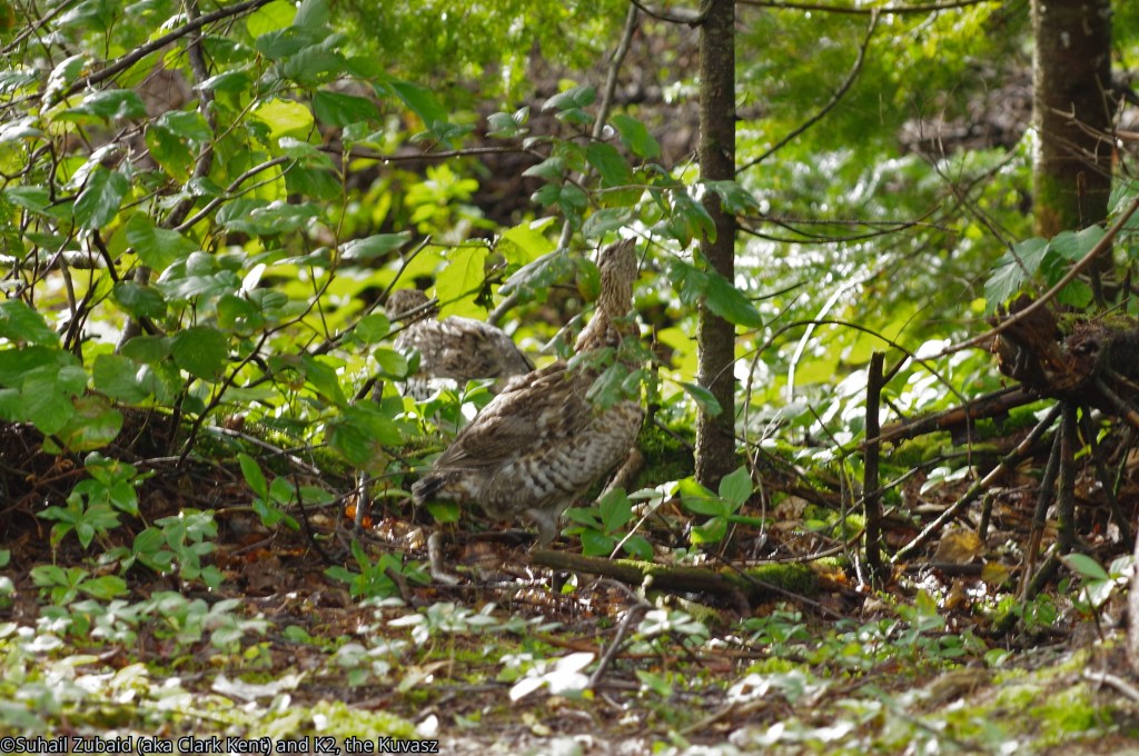
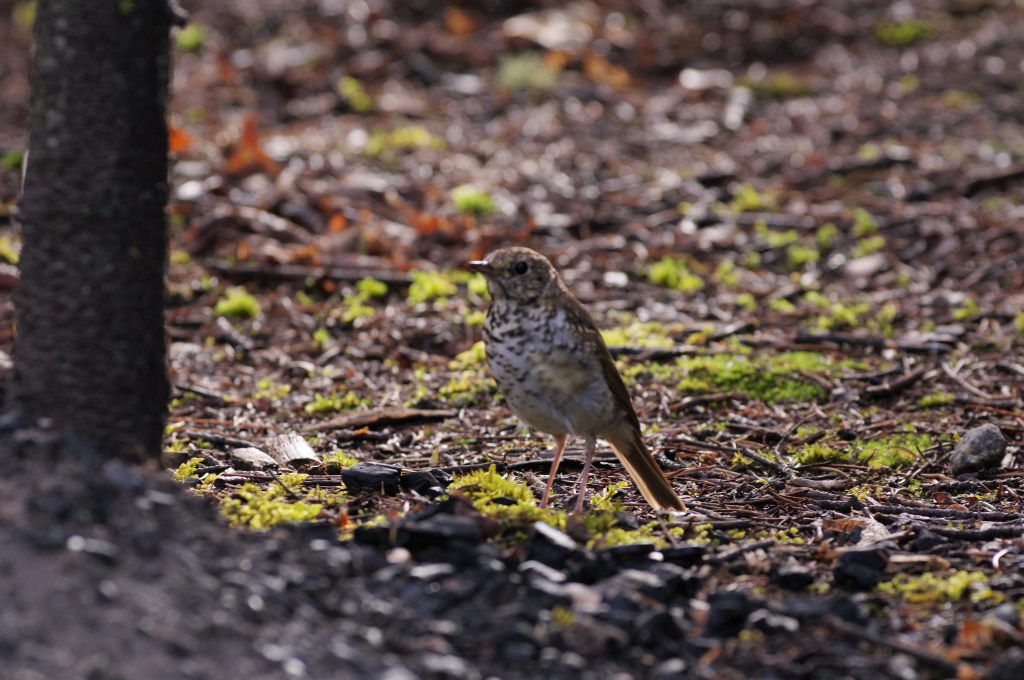
As the youngest member of family, 4-1/2 years old Zakaria, started to spend his energy running up and down the trail, a covey of grey partridges headed for safety of the bush. Chipmunks, on the other hand, continually came out in the hope of getting free morsels of food. A savannah sparrow was taking a bath in the water puddle made by overnight rain.
The trail itself, mostly along a shallow river, was easy to traverse. There were backcountry camping spots along the river that were occupied by the campers, but the activity was almost unnoticeable.
The river had created swamps as it flowed along the trail, which gave the appearance of African riverine wilderness.

My family, was hiking at Baie-Sainte-Marguerite Sector of Parc national du Fjord-du-Saguenay along Rêverie Sainte-Marguerite.
Objective: to watch Beluga whales in Saguenay River as it flowed through Park national du-Fjord-du- Saguenay. The whales, resident of Saguenay – St. Lawrence National Marine Park, sail up the Saguenay River for calving up to the point of confluence of Saguenay River and Reverie Sainte-Marguerite.
The park is divided into three sectors, the other two being Baie-Éternité and Baie de Tadoussac. The park is located on both sides of the fjord.
What is a fjord, you may ask?
National Geographic defines a fjord as a long, deep, narrow body of water that reaches far inland. Fjords are often set in a U-shaped valley with steep walls of rock on either side. Fjords are found mainly in Norway, Chile, New Zealand, Canada, Greenland, and the U.S. state of Alaska. Sognefjorden, a fjord in Norway, is more than 160 kilometers (nearly 100 miles) long. Fjords almost always open out into the sea. To those who doubt it, Saguenay river fjord is indeed a fjord that is unusual in the sense it open out into another river – St. Lawrence, which has become almost a sea at this point.
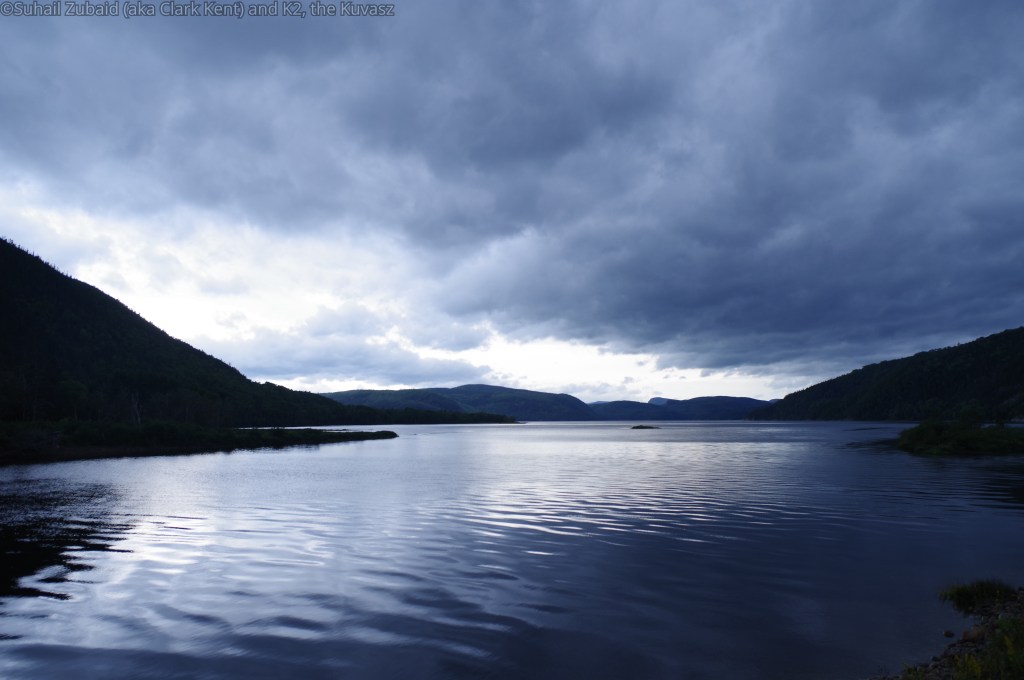
When we reached the confluence of Sainte-Marguerite and the Saguenay rivers, we found the scene to be captivating to say the least. The Saguenay River was flowing through the fjord on which the provincial park (national park in Quebec) is based with heavily forested steep hills on either side.
On our side of the river, gulls and great blue herons waited to scoop fish from the river waters, while a pair of Ospreys circled above to do the same.

A young lady researcher was on the site, her eyes trained on the expanse of the River where belugas were expected. A husband and wife team from Montreal started a conversation in French with her. Noticing our presence, the husband turned the conversation to English and asked where we were from. Finding out that we were from Mississauga, he shared that he lived in Georgetown for many years and seemed to know our neighbourhood very well.
The husband and wife were curious about the identity of some birds.
The young researcher put her hands up in the air in resignation, laughingly admitting, “I only know about whales”.
Using my long telephoto, I identified several birds for them and earned a round of applause.

As the day came to end, we headed back for our camping site. It was a fun day.
We had arrived in the park the day before and had parked our RV at the Park’s RV campsite, close to the Visitor Centre, that offered total privacy.
We put our camp in the Park too, along with a hammock, and barbeque grill. The youngest member of the family enjoyed his time in the tent.

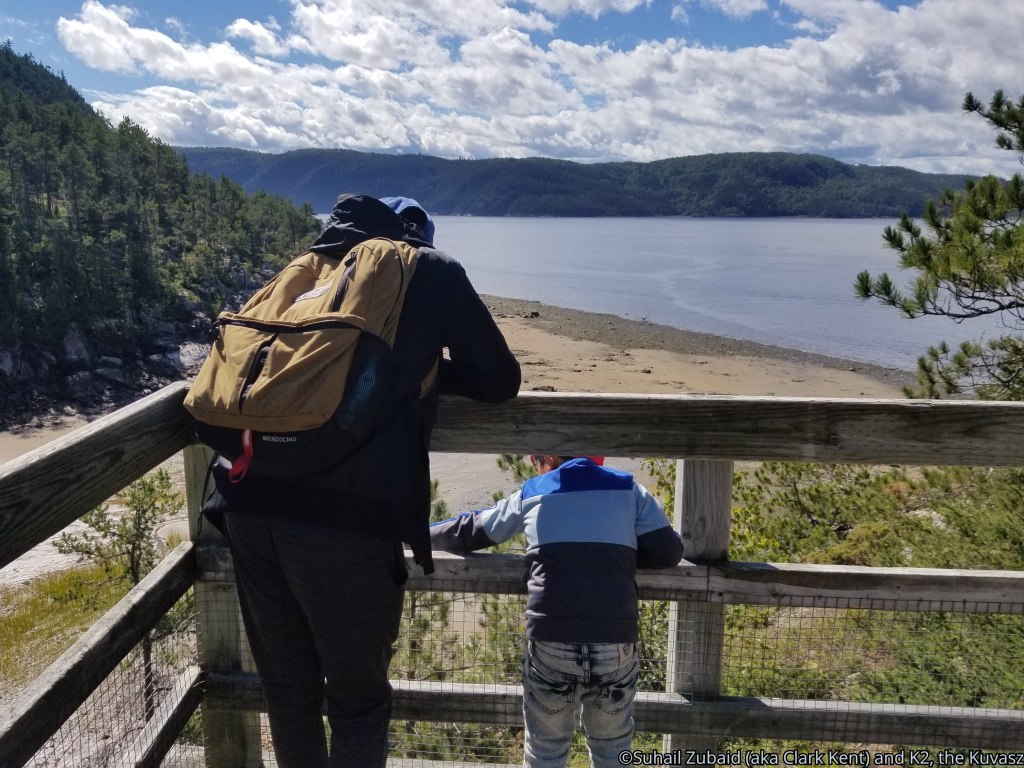
The views at Visitor Centre
After doing some souvenir shopping at the Visitor Centre, we explored the sprawling grass field and gardens that offered panoramic views of the fast flowing Rêverie Sainte-Marguerite and the steep hills on the other side of the River.
A woodchuck was busy foraging in the broad daylight.
We sat there in trance, taking in the scenery.

The next day, we were hiking on Sentier de I’Estuaire, exploring an unusual feature in the heavily forested land that was managed by the Park.
Baie de Tadoussac sector – Hiking at Sentier de I’Estuaire, La Maison des Dunes
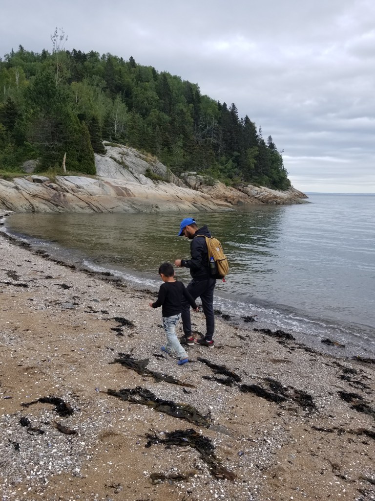
Parking our 34 feet long RV on the road side, we descended down on a sharp slope of a mammoth sand dune to reach the beach littered with dead seaweed. Looking up to where we had descended from, made us cringe.

The dunes sector of the Parc national du Saguenay opened out onto the Baie-du-Moulin-à-Baude, near the picturesque village of Tadoussac and seemed to represent a portion of the heritage of the last glacial era.
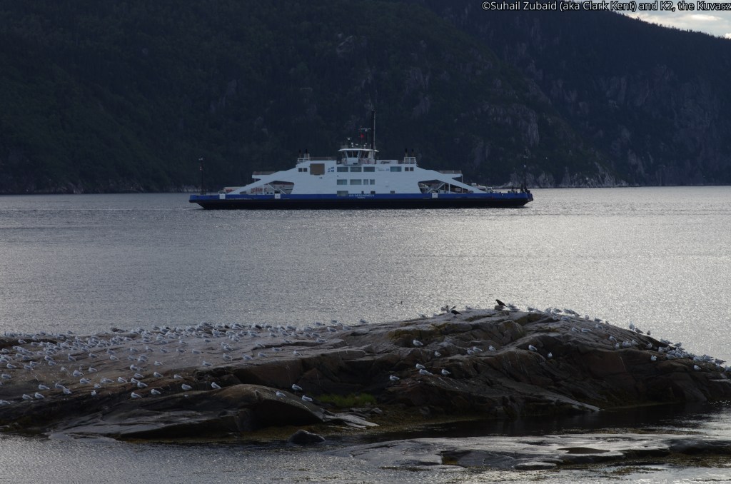
From here, had we been patient, we could have seen whales of St. Lawrence River. The whales can also be observed by a ship (see the picture below), which we had adventured few days earlier, but that can be very expensive.
Our whale watching excursion report is here for you to read.
We came down the sand dunes and went up by taking a trail that passed through a forest. On the way, we found rock pools from where one could have views of the St. Lawrence River.

Back on top again, Observatoire Ornithologique de Tadoussac (OOT) provided birders a chance to see migrating waterfowl and other birds. The building seemed deserted because of the pandemic situation.
Historically, the site was owned by Molson family who used to rent out the geographic feature for a new sport that was invented in Tadoussac in the 1940s – sand skiing. The site was used for popular sand-skiing competitions up until the 1980s; the sand dunes attracted curious spectators from all over the world. In 1983, the Parc national du Saguenay bought the location from the Molson family to showcase it as a protected area.

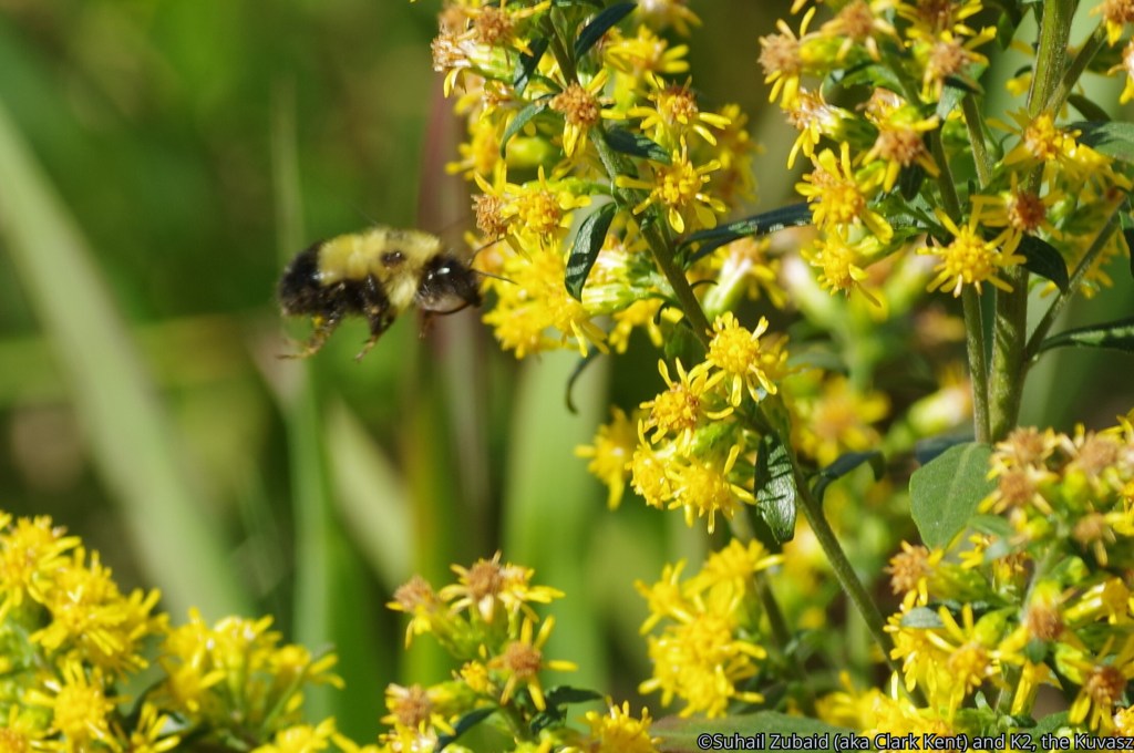
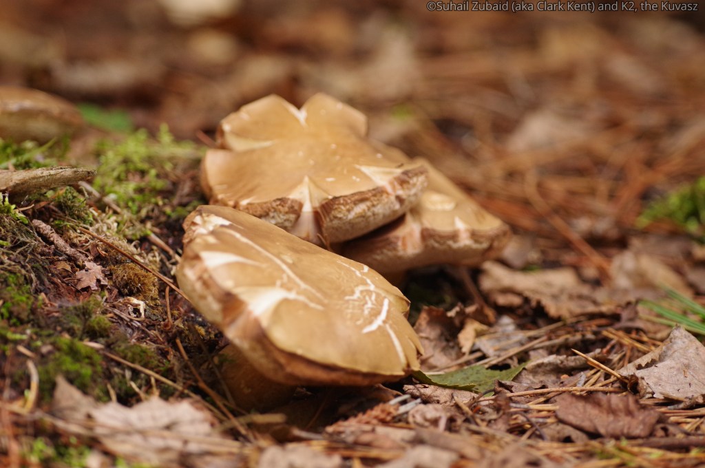
Flora and fauna of the park that we saw
Other than the ospreys, great blue herons, common eiders, and gulls, we were able to see the following:


Hiking at the Park trails within Tadoussac
The Parc national du Saguenay has set up two Km of interpretive hiking trails in the very heart of the picturesque village of Tadoussac. We hiked on the trail that started near the Marine Mammal Interpretation Centre (CIMM) and reached the Islet Point. This is called Sentier de la Pointe-de-l’Islet trail and reportedly takes 20 minutes to complete the 0.8 km, but in actuality, it took us eternity to complete due to the reasons. Please read on.
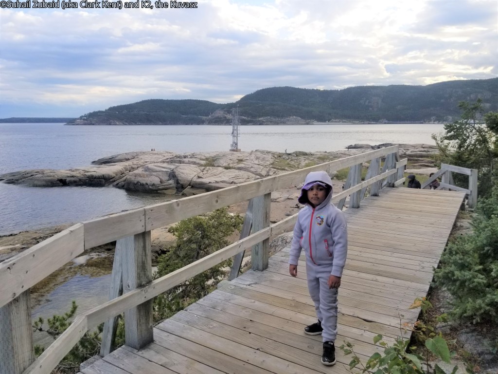
Reaching the Islet Point, we could see, to our right, the ferries plying on the Saguenay River that had brought us with our RV, along with several other 18 wheelers and vehicles, from the west (or more appropriately south) bank of the River to the village of Tadoussac on the east (north).
Directly in front of us was an islet where hundreds of gulls were nesting down at the dusk.
To our left, we could see the Saguenay River flowing down toward its confluence with St. Lawrence River.
Various interpretive panels dotted the trail. We took our time reading those panels. The setting sun was mesmerizing and we sat there for a long time till the sun and the ensuing light at the horizon disappeared. That respite let Zakeria, the youngest member of the clan, to play his own games.

From Camping Tadoussac, where we were camping, we went on a hike on 1.2 km long Sentier de la Coupe trail. Situated in the middle of the village, Anse-à-l’Eau hill provided a 360 degree view of the Saguenay River, the St. Lawrence River and the village itself.
We wanted to hike at the Tadoussac beach, located much further down, at low tide on a km long Sentier de la plage trail all the way to the Rouge Point on the Bay to the left. However, it got windy and chilly and we decided to abort the hike.

Where to stay?
Due to the pandemic we had decided to be RV bound. We parked at ‘Camping Tadoussac’ and at the RV camping site at Baie-Sainte-Marguerite Sector of the Park. Although we found the RV campsite experience within Parc national du Fjord-du-Saguenay convenient for exploring the Park, there were backcountry campgrounds in this sector of the park too.


In addition, we saw a number of hotels, BnBs, inns, and motels in Tadoussac and its environs.
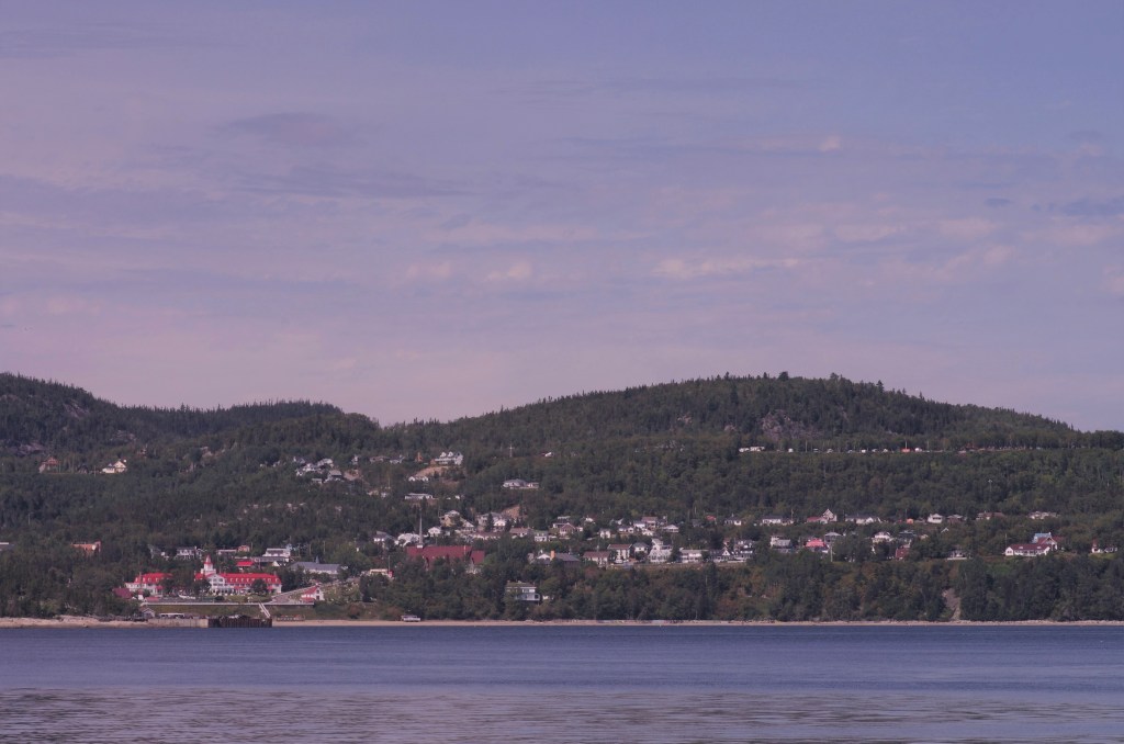
Obviously, Hotel Tadoussac stood majestically at the Bay and could be seen even from far off in the St. Lawrence River.
final word
Until our next blog, au revoir! Be outdoorsy, embrace diversity, and support causes for the conservation of nature!

This was so much fun to read. It really took me back!
In Zak’s words, “Can we go back, and do the same vacation again?” Haha
LikeLike
I am liking the title of the blog. I have been here a few times, but on the other side of the river having more bigger attractions. That a long drive if you have strict schedule. You should visit there for longer number of days. Also build a hide for taking pictures of more wild animals.
LikeLike
Thank you, William for liking my blog and for recommendations. National/Provincial parks of Quebec are huge and beautiful. I am 100% sure that I will be back there with a better plan 🙂
Regards,
LikeLike
Nice little trip you and your young ones had in this National/Provincial Park. Beautiful shots and information you have documented for future users!
Two years back I did the Point de vue du Géant via Sentier de la Rivière. It is about 9 kilometer long near Riviere-Eternite, moderately used by hikers and is rated moderately difficult to do. May I suggest that you visit the Baie Eternite sector of this Park and hike on this trail. You pass by a lake, a small waterfall, and then finally, the view from the top is gorgeous. This trail packs up everything for everyone.
LikeLike
Hi Alastaire,
Thank you very much indeed for reading my blog and leaving nice comments. Thank you also for the great suggestion. I will surely look into doing this trail.
Regards,
LikeLike