
An Unusual national conservation area
It got very cold on the upper deck in late May and all four of us relocated to the main deck of the glass-bottom ship. The water was so clear that we could see it as if they were lying in the open. It was not only us on the ship looking back in history, there were some sea kayakers too who had pedaled to the site and were observing them.
We were all looking at the 2 of the 22 shipwrecks that the sparkling clean waters of Fathom Five National Marine Park boasts of. Highlights of this park include most pristine waters of all the great lakes, oldest shipwreck (150 years old), and a 1,860 years old eastern white cedar discovered on the ancient cliffs of Flowerpot Island.

The park is a part of much larger ecosystem with Niagara Escarpment (a World Biosphere Reserve) as a backbone. Our hikes with K2 the Kuvasz boy in other conservation parks in Niagara Escarpment will become part of future hubs.
Like the neighbouring Bruce Peninsula National Park, Fathom Five National Marine Park is located in close proximity to somewhat densely populated southern Ontario. It is, therefore, popular with the tourists who are attracted to its water and land-based activities, including scuba diving, boating, and hiking.
Start from the Visiting Centre
We started from the Visiting Centre, which caters both to the Bruce Peninsula National Park and Fathom Five National Marine Park.
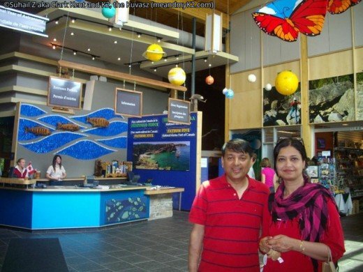
Here, we watched an introductory facts laden high-definition movie on the two parks, visited an exhibit gallery showcasing everything from a full-size lighthouse to geological features to wildlife to shipwrecks to archaeological relics, and shopped for the souvenirs in the gift shop.
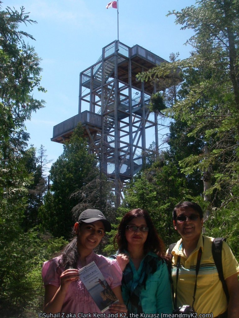
We also climbed a 20m (65’) tall tower on its premises for a bird’s-eye view of the park. The tower is located at a distance of about 800 meters behind the parking lot. It is visible from all over.
Next, do a Sweaty hike on the Burnt Point Loop
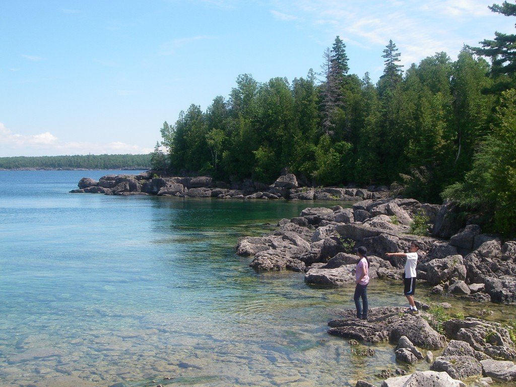
The 3.5 km track that starts and finishes at the Visitor Centre, took us through a dense forest. It was so humid in late June that we were sweating profusely. However, the trail opened up on the Georgian Bay at Dunks Point and offered us a respite.
Trying to reach the lakeshore over the cobble stones drained us of the remaining energy to the point that we decided to call it a day and took a late lunch.

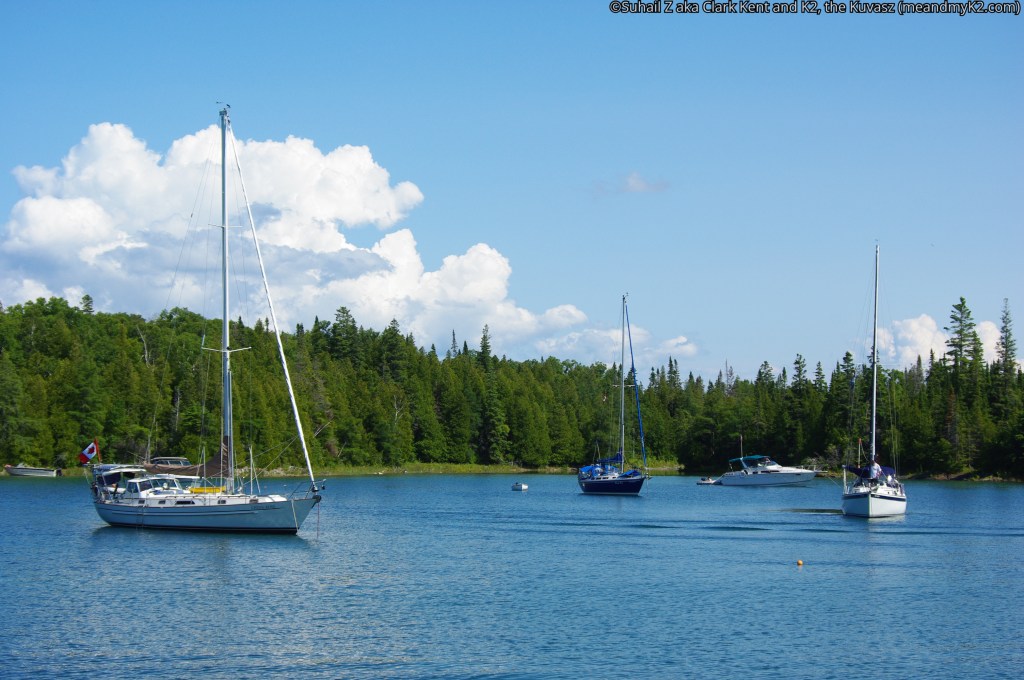
Cruise over and around the shipwrecks:
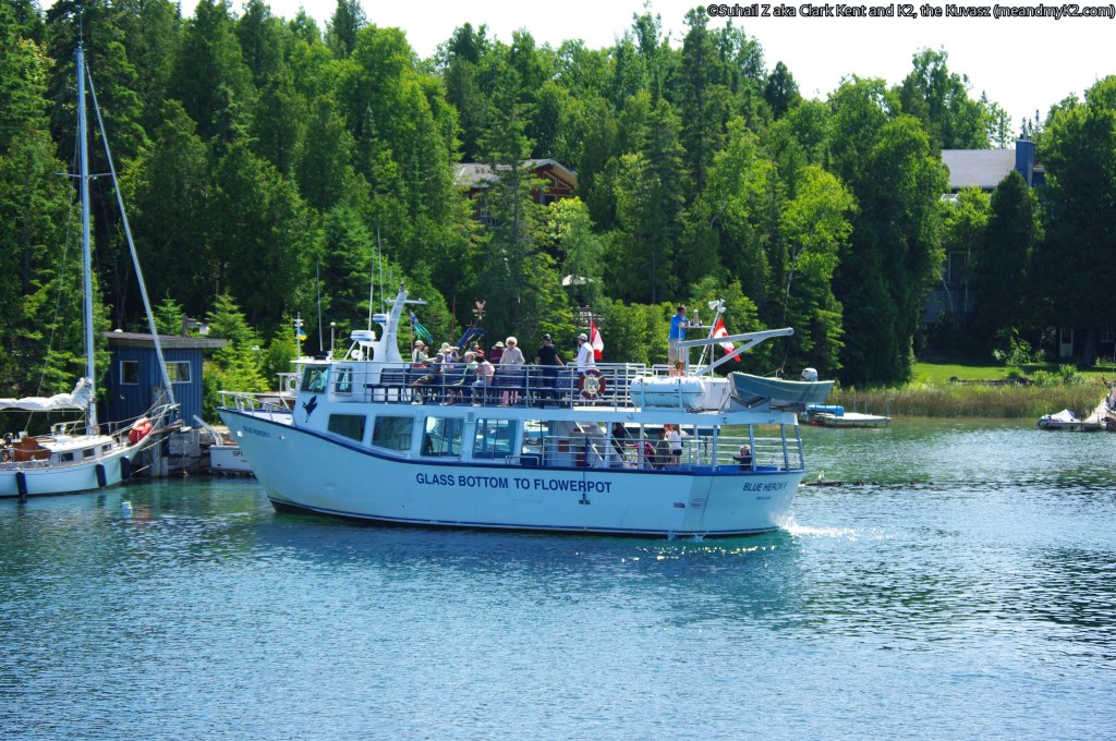
We took Great Blue Heron cruise from Tobermory. This is reportedly Canada’s largest glass bottom boat and can carry up to 125 passengers. Great Blue Heron departs from Little Tub Harbor, located near the downtown Tobermory, at regular intervals.
Our two-hour cruise began with a visit to two nineteenth century shipwrecks located in Tobermory’s Big Tub Harbor. The water was so clear that we could see the shipwrecks clearly. Scuba divers were preparing to dive to observe the shipwreck even more closely.

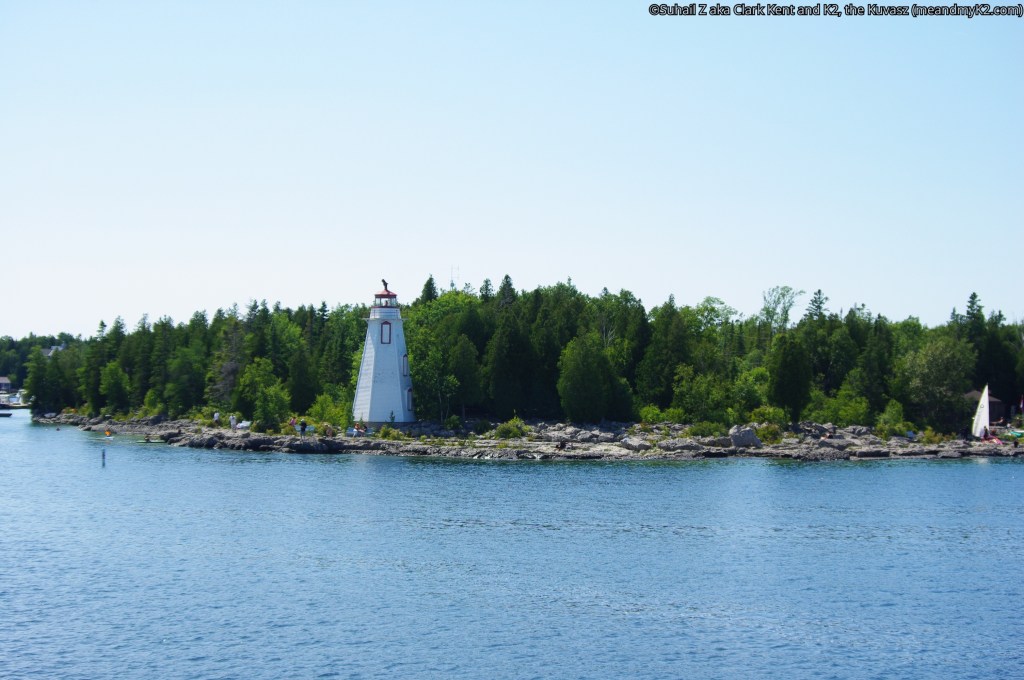
a historic lighthouse
The cruise ship then sailed through the south and west sides of Russel Island. We noticed shoals typical of the Lake Huron side of the Bruce Peninsula. We had lodged ourselves on the front side of the top deck only to be tantalized by cold wind even on a seemingly hot day. Russel Island is approachable by sea kayaks.
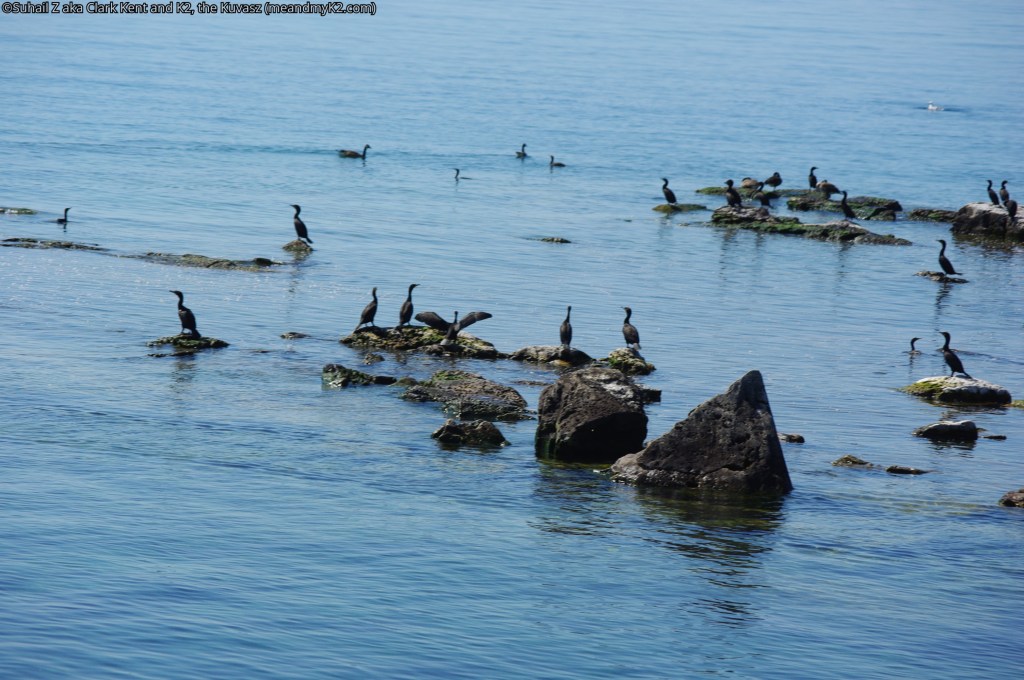
Cormorants’ resting/sun basking site
The ship then sailed northward, cutting across the Devil Island Channel and to a small Island called White Rock. This island was a nesting site for the Double Crested Cormorants. We took lots of pictures of the birds resting on the island taking the sunshine in.
This reminded us of another sailing expedition and that was on Lake Osceola, Orlando, where the guide had educated us on the difference between Cormorant and Anhinga.

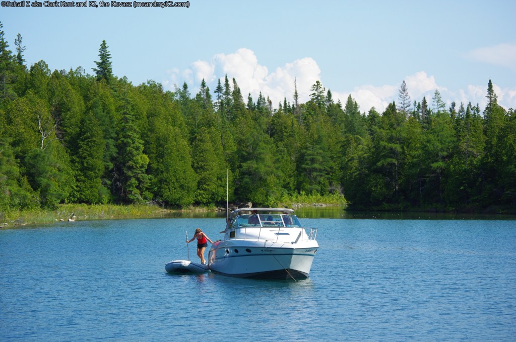
Water activities around Cove Island
The cruise then headed into seemingly the prettiest part of the trip, the southwest corner of Cove Island.
The water was so clear that we could see fish at the bottom of the lake. By then, passengers had relocated on the main deck of the ship, because it was very cold on the upper deck.
Due to the calmness of waters in the island bay, we saw many boaters enjoying fishing, scuba diving, snorkeling, jet skiing, canoeing, kayaking, pedal boating, and other types of water sports around Cove Island.
The greenery and beauty of the overall surroundings was certainly matchless.

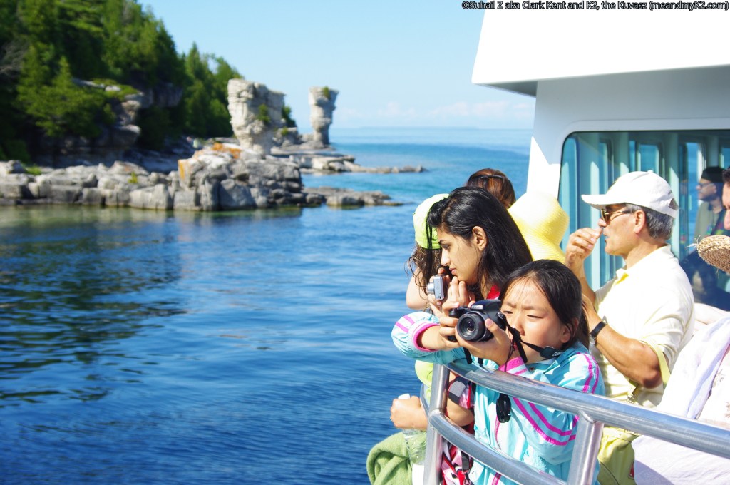
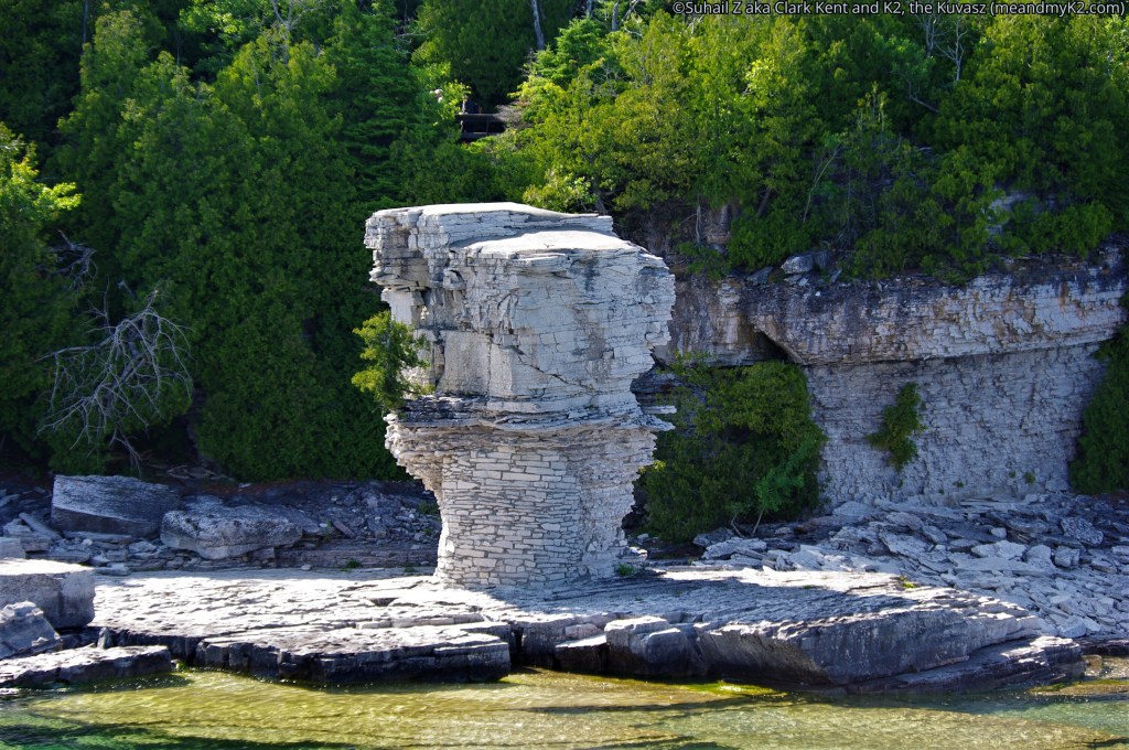
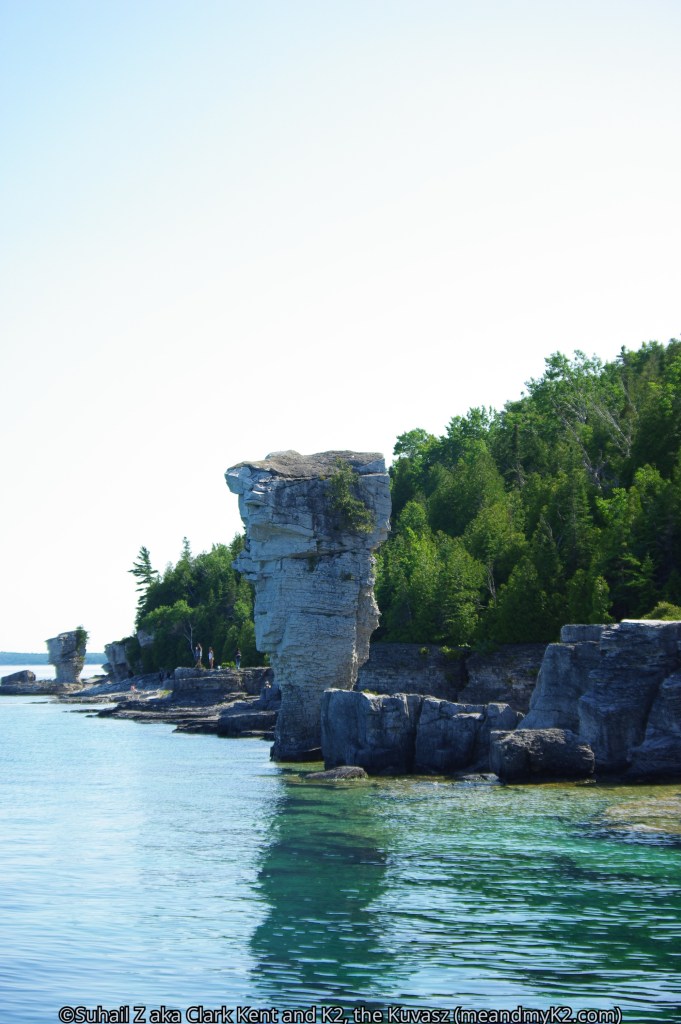
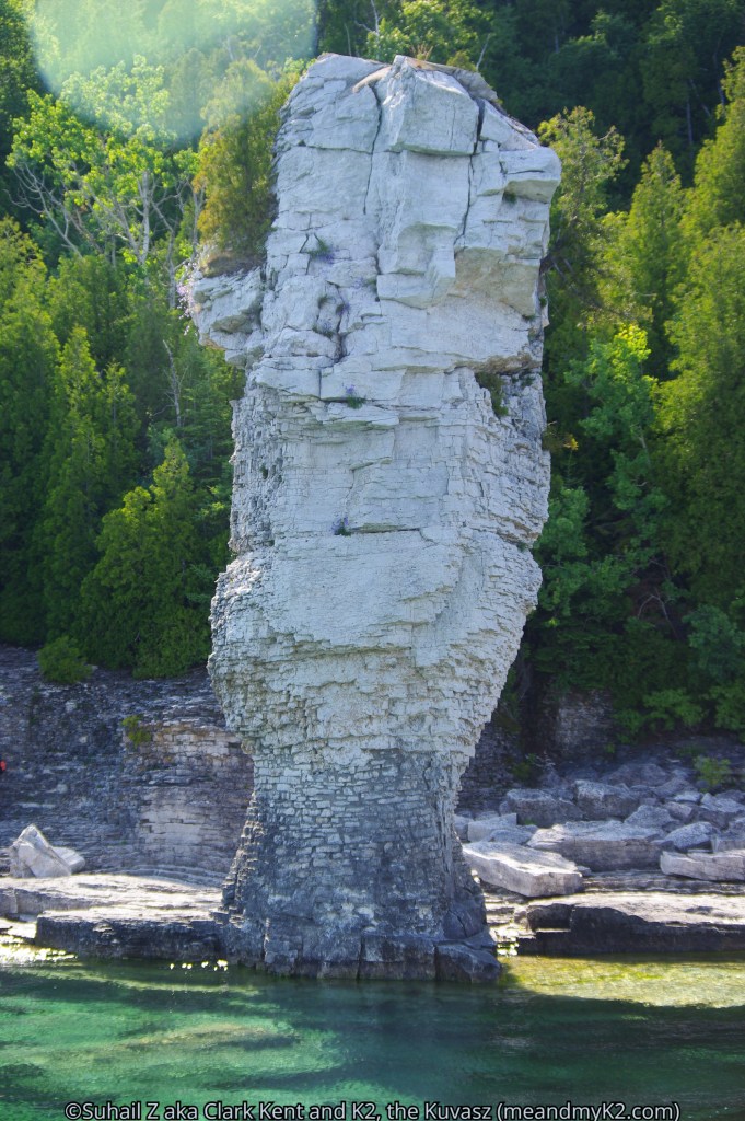
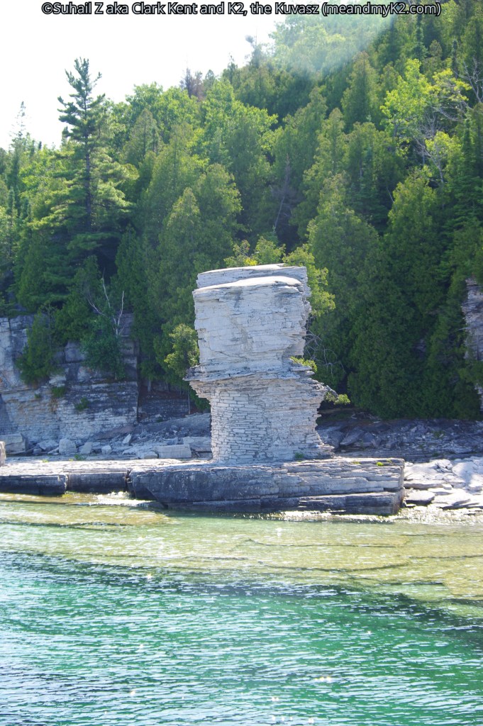
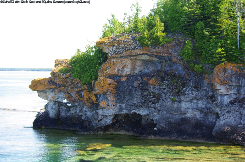
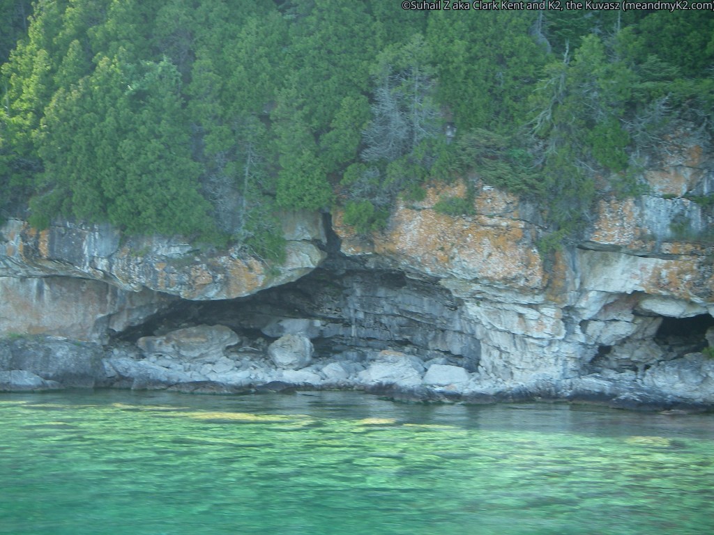
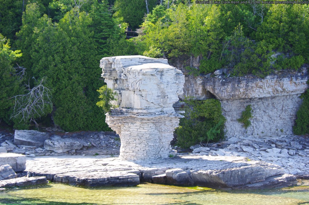
Unusual rock formations – Flowerpot Island
We continued cruising along the south shore of Cove, through the Otter Island Channel and east to Flowerpot Island.
This 200 hectares island gets its name from two unusual rock formations on its eastern shore. This is the only Island where camping and hiking is permitted. We cruised right by the Flowerpot rock formations where we took lots of pictures. There were many tourists either hiking over the rocks or sitting by the Flowerpots rock formations.
Although we were not in a position to do any hiking on the island, for those interested in taking another ship there, the dock is located at Beachy Cove and it is a 15 minute hike up to the Flowerpots.
Unique features of wildlife
We were able to see many resident waterfowls in the late June trip, although one should plan a visit for May or early October to see the maximum number of bird species migrating through the islands during their spring and winter migrations.
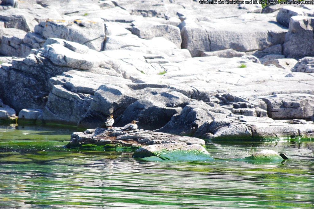
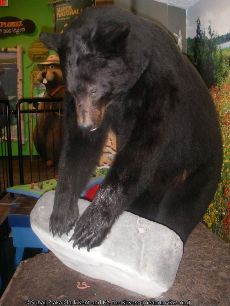
Cormorants made a pleasant site everywhere. Bald Eagles, bears, dears and rattlesnakes call Cove Island home because it is a large island and is closest to the mainland. These species are not found on Flowerpot Island, because it is farthest from the mainland and these species have not made it to that island.
Garter snakes and red squirrels are present on that island though.
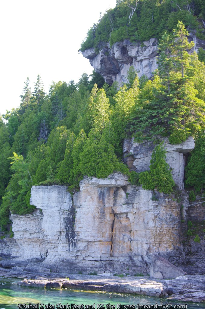
Unique Geological features
The park supports unique geological features of Alvars and eroded rocks in strangest of shapes.
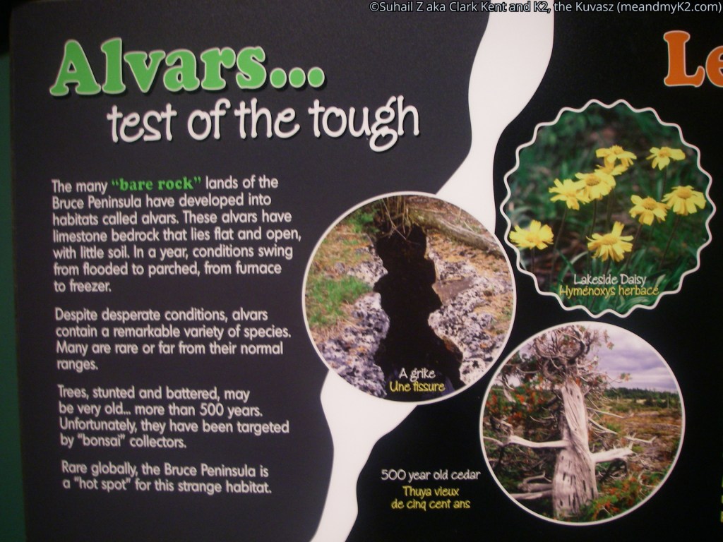
Alvars are naturally open habitats with either a thin covering of soil or no soil over a base of limestone or dolostone. This feature is found only in the eastern European Baltic region and the North American Great Lakes Basin.
Almost 75 percent of North American alvars are located in Ontario. Fathom Five National Marine Park and the neighbouring Bruce Peninsula National Park are great places to observe these features. We had to be careful during hiking always keeping an eye on a fissure or a crevasse on the hills and sprawling roots of nearby trees on the trail.

Unique features of plant life
We were amazed at the strange twisted and ‘J’ shaped eastern white cedars trying to support themselves on bare rocks facing severest of elements like wave impact and weight of heavy frozen snow during winters. We later found out the fact that many of the cliff hanging white cedars are over 500 years old was not known until 1980s.
How to get there?
The Park can be reached by taking north exit of Hurontario Street (Highway 10) from Highway 401. Continue until Highway 10 north joins Highway 6 north (coming from Guelph) at Owen Sound. Follow Highway 6 north past Owen Sound and Wiarton (a town at the base of Bruce Peninsula) all the way to the picturesque Tobermory, which is the last town on Bruce Peninsula with a population of 4,200.
Where to stay?
For those interested in an affordable and comfortable extended stay, Tobermory and Highway 6 on its last 5 km stretch offer reasonable accommodations. However, advanced booking is highly recommended due to the popularity of the peninsula with the tourists.
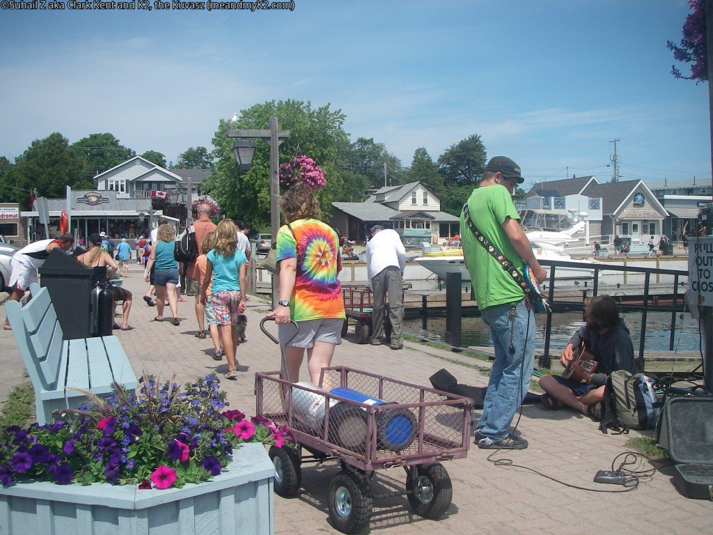
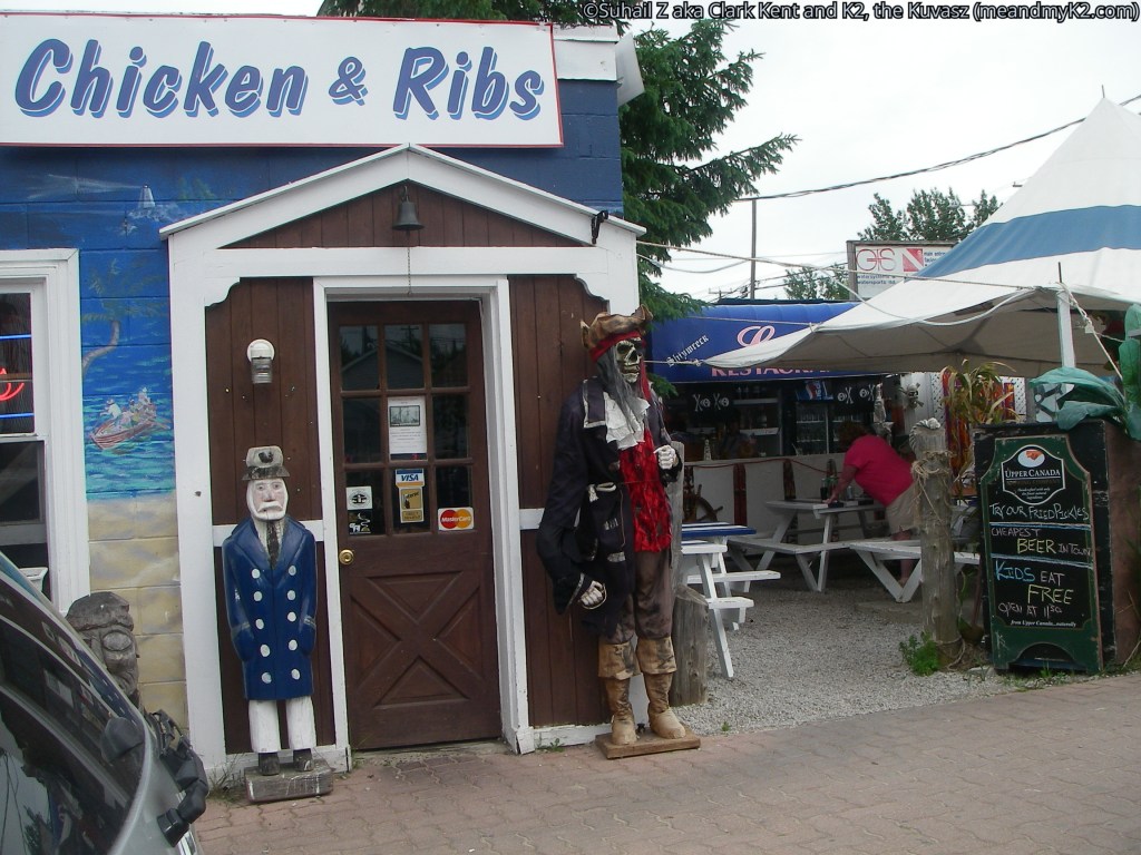
Tobermory itself is has many stores, outdoor fitters and restaurants catering to the tourists.

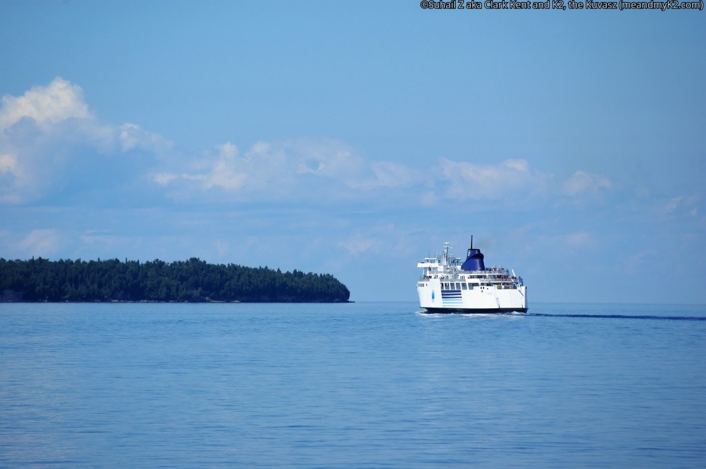
Tobermory is also the home of the Chi-Cheemaun Ferry, the southern terminus to very touristic Manitoulin Island. Reservations are definitely recommended for the 7:00 am sailing in July and August. And of course, you can take your car on board.
Reflecting on the day of the cruise, we wished we were into scuba diving too. That would have enabled us to dive down and check the shipwrecks out buried deep in the crystal-clear waters of the Georgian Bay. Constrained by our lack of training, we let our imaginations run wild. But some of our fellow visitors were fortunate for they really enjoyed every bit of scuba diving, bestowing such title on the park as “scuba diving capital of the world’.
